All notices listed below are in effect, until such time that they are downgraded. Residents will be notified via our cell phone alerting tool, Linn-Benton Alert System, our website here, and social media when it is safe to re-enter their areas. Please, do not call 9-1-1 unless you have an active emergency.
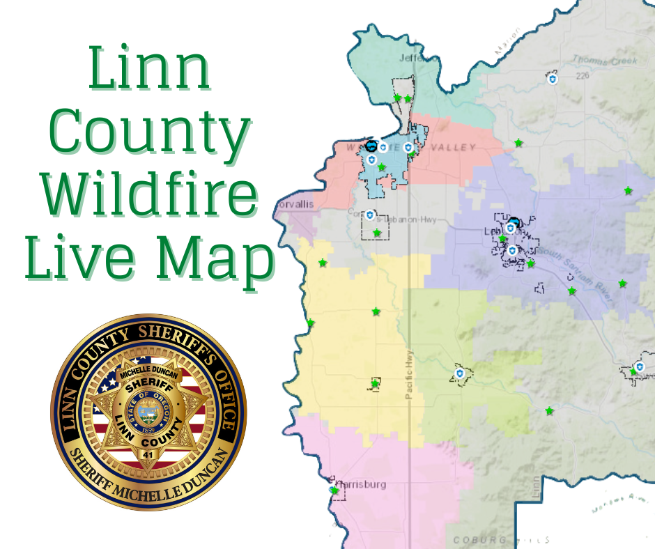
View the Linn County Wildfire Live Map for detailed imagery of active fires, evacuation areas, and additional details.
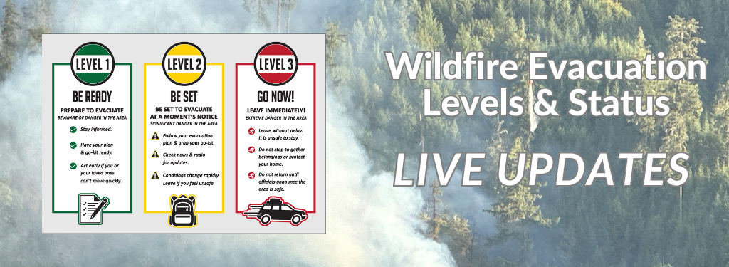
About Evacuation Levels
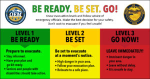
- 🟢 Level 1
- “BE READY” for potential evacuation. Be aware of the danger that exists in the area and monitor emergency services websites and local media outlets for information. This is the time for preparation. Older adults and people with disabilities are encouraged to take action early. Consider moving pets and livestock.
- 🟡 Level 2
- “BE SET” to evacuate. Be ready to leave at a moment’s notice. There is significant danger in the area. Relocate to a safe place outside of the affected area. Let loved ones know you’re safe and where to meet.
- 🔴 Level 3
- “GO NOW!” Leave immediately! Danger to the area is current or imminent. It is unsafe to stay and threatens the safety of you, your family and first responders. Do not gather belongings or make efforts to protect the home. Emergency services may not be able to assist you further if you stay. Do NOT return home until officials declare the area safe.
View the State of Oregon Emergency Management’s Evacuation Flyer and the State of Oregon Wildfire and Hotspots Dashboard
ACTIVE EVACUATIONS AND ALERTS (Updated July 18, 2024 @ 2015 hours)
🔴 Level 3
- A large portion of the Sweet Home Ranger District has been put on a Level 3 GO NOW Evacuation Alert due to the Pyramid Fire