Lookout Fire Update: August 18, 2023, 12:45 p.m.
Quick Facts-
Size: 5,537 acres
Containment: 0%
Start Date: August 5, 2023
Point of origin: 3 miles North of McKenzie Bridge, OR
LOOKOUT FIRE MOVES NORTHEAST, CAUSES EVACUATION ALERTS
The Lookout Fire burning in Lane County near McKenzie Bridge along Highway 126 is currently at 5,537 acres. Overnight, the fire crossed over the border Linn County shares with Lane County. Both Sheriff’s Offices are coordinating efforts with Lookout Fire Command and the Incident Management Team.
The Lookout Fire is either currently threatening popular recreation areas in southeast Linn County, or has the strong potential to threaten those areas if fire and weather changes occur. Linn County Sheriff Michelle Duncan is concerned for campers, hikers and visitors to the areas of Olallie Campground, Trail Bridge Reservoir & Campground, Smith Reservoir & Campgrounds, and Tamolitch Falls area.
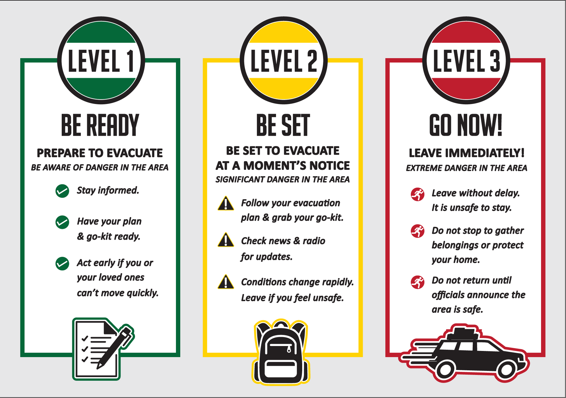
LEVEL 3: GO NOW Evacuation Zone
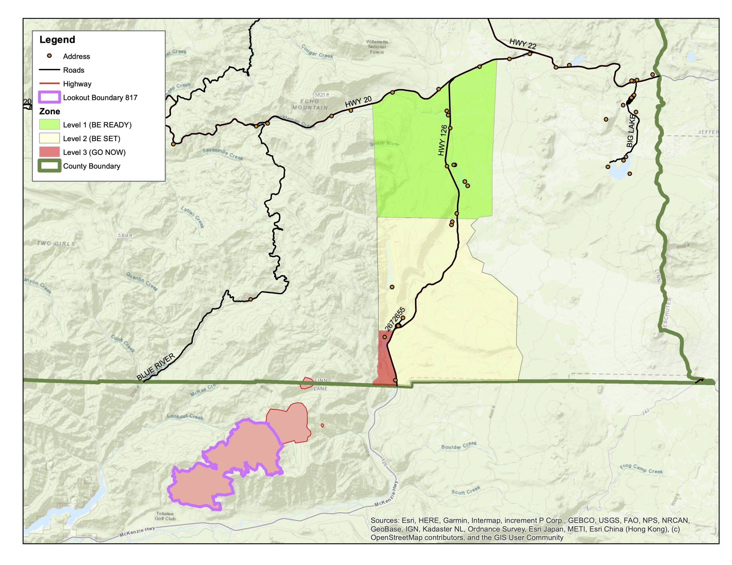
Sheriff Duncan is ordering a LEVEL 3 (GO NOW) Evacuation Order for Olallie Campground, Trail Bridge Reservoir & Campground, and the trail systems and roadways north of the Linn County line, and west of Highway 126, extending north to intersection of National Forest Service Road 730 and Highway 126 (entrance to the Carmen-Smith Hydroelectric facility). Refer to the map located at http://tinyurl.com/LookoutFire and the attached map image.
Danger is current or imminent and you should evacuate now. If you choose to ignore this notice, emergency services may not be able to assist you further. DO NOT DELAY leaving to gather items or protect your home. THIS WILL BE THE LAST NOTICE YOU RECEIVE. Entry to evacuated areas may be denied until it is safe.
LEVEL 2: BE SET Evacuation Zone
Sheriff Duncan is ordering a LEVEL 2 (BE SET) Evacuation Order for the area from the east side of Olallie Campground east to the Willamette National Forest Boundary, north along boundary to Ice Cap Campground and Trailhead, then west to encompass Lakes End Campground and trail system, and south in line with the intersection of National Forest Service Road 730 and Highway 126 (entrance to the Carmen-Smith Hydroelectric facility). Tamolitch Falls/Blue Pool and Smith Reservoir are within this LEVEL 2 (BE SET) Evacuation Zone. Refer to the map located at http://tinyurl.com/LookoutFire and the attached map image.
LEVEL 1: BE READY Evacuation Preparedness Alert
Sheriff Duncan has ordered a preparedness alert LEVEL 1 (BE READY) evacuation zone for areas north of Ice Cap Campground, extending east to the Willamette National Forest boundary, and north in line with Highway 20. This includes all areas around Clear Lake, and Clear Lake Campground. Refer to the map located at http://tinyurl.com/LookoutFire and the attached map image.
Highway 126 remains open to all vehicle traffic. Anyone traveling the area should proceed with caution, and yield to all emergency vehicles. Travelers are advised to check www.TripCheck.com for the latest in roadway information.
All areas mentioned have poor or nonexistent cell phone reception. This presents a danger to any persons using the areas within the listed zone. While LEVEL 1 and LEVEL 2 areas remain open, persons visiting should stay alert and prepared, as evacuation levels can change with fire conditions quickly, and alerts may not be able to be delivered to cell phones in the area.
Much of the areas listed above are within an existing U.S. Forest Service Emergency Closure. By this declaration, no persons are to be on the roadways or trails within the closure area, or enter or remain on the National Forest Service lands covered by the closure.
For more information on evacuations, visit https://www.linnsheriff.org/ and @LinnSheriff.
The Lane County Sheriff’s Office has also issued evacuation alerts. Citizens are encouraged to visit https://lanecounty.org/lookoutfire and their Facebook page at @LaneCountySheriffsOffice
Important Links:
Lookout Fire Map: https://tinyurl.com/LookoutFire
Lookout Fire 2023 Facebook: https://www.facebook.com/LookoutFire2023
Air & Smoke Map: https://fire.airnow.gov/
Willamette National Forest Facebook: https://www.facebook.com/willamettenf
Fire Closures Map: Willamette National Forest https://www.fs.usda.gov/detail/willamette/alerts-notices/?cid=fseprd552029